
One Ton Post: The Long Way to a Line
Some detours make immediate sense. Others make sense only after you’ve done them.
The One Ton Post fell firmly into the second category. We added nearly 400 kilometres to our route because Cameron read about it, decided it sounded interesting, and couldn’t let it go. Neil was…cautiously optimistic. That’s usually how these things start.
The drive itself is part of the story. Long, flat roads. Big distances between towns. A landscape that doesn’t give much away at first glance. By the time we turned off toward the Barwon River, the idea of a single post marking something meaningful felt both unlikely and oddly exciting.
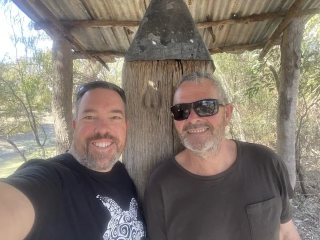
When we arrived, the post didn’t disappoint.
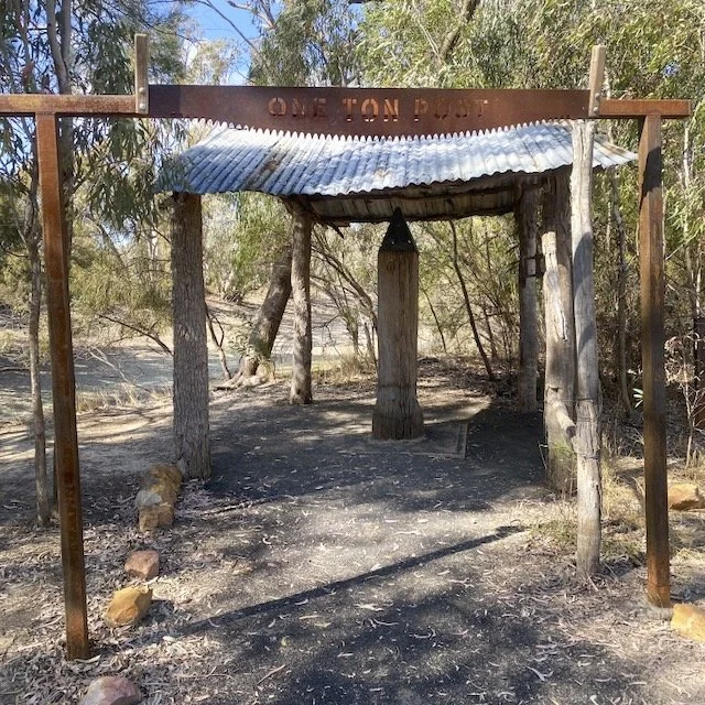
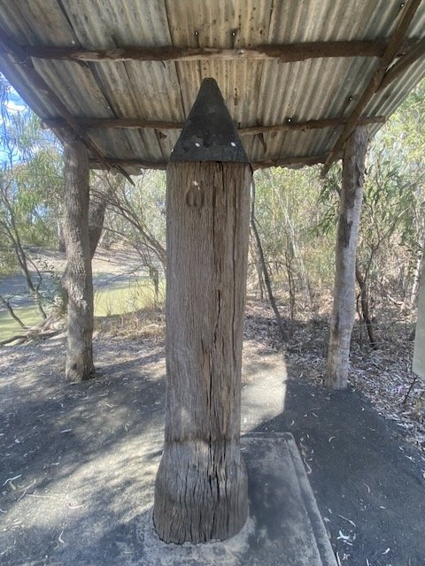
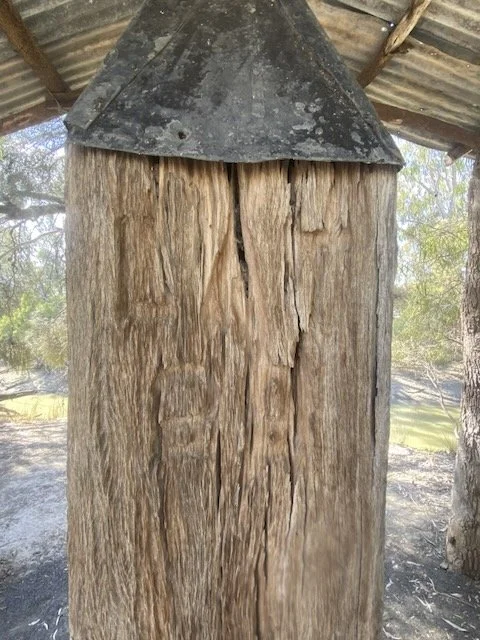
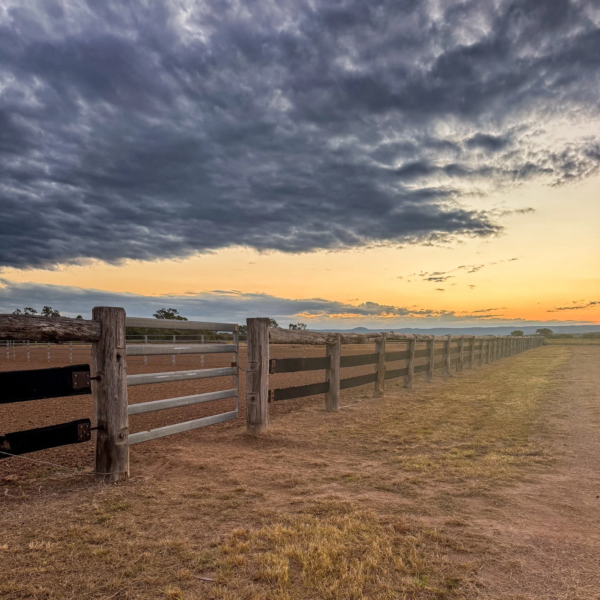
The One Ton Post sits quietly on the west bank of the Barwon River, outside the small border town of Mungindi. There’s no grand build-up, no visitor centre fanfare. Just a solid iron marker, planted firmly where it was meant to be, doing the job it was placed there to do more than a century ago.
What makes it special isn’t its appearance. It’s what it represents.
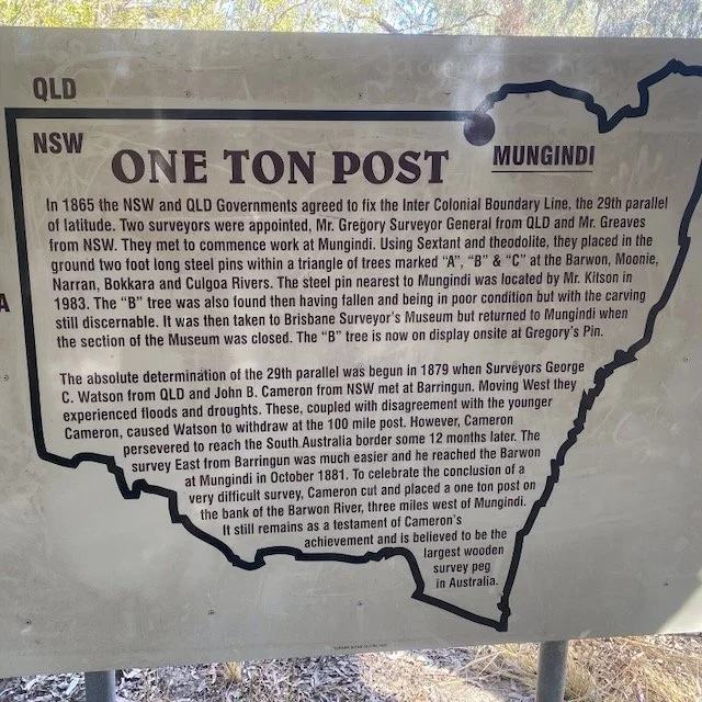
This post marks the eastern end of the longest straight section of the Queensland–New South Wales border. The western end sits way out at Cameron Corner. Between the two points, surveyor JB Cameron spent years painstakingly surveying the twenty-ninth parallel through remote country, long before GPS, sealed roads, or reliable supply lines.
When he finished the job in 1881, he placed this one-ton iron post to mark the achievement. And remarkably, it’s still the original survey peg. You can put your hands on the very marker he erected himself. At Cameron Corner, the original marker has long since been replaced with concrete. Here, the real thing remains.
Standing there, it’s hard not to feel a quiet sense of respect. Not just for the effort involved, but for the confidence it took to draw a straight line across such a vast, unforgiving landscape and say, this is where it runs.
Was the detour worth it? Absolutely. Not because there’s a lot to do, but because there’s a lot to think about. The One Ton Post turns an abstract idea on a map into something you can actually stand beside.
Also, check out the photos below for a rare photo of Cameron before the beard!
We share places like this through our Travel Dispatch, usually because we couldn’t talk ourselves out of visiting them. If that sounds familiar, you can join us here
One Ton Post
The One Ton Post is a historic survey marker located near Mungindi on the Queensland–New South Wales border. It marks the eastern end of the straight section of the border surveyed along the twenty-ninth parallel of latitude.
Erected in October 1881 by surveyor JB Cameron, the post commemorates the completion of a multi-year surveying effort that stretched from Cameron Corner in the west to the Barwon River in the east.
How to Get There
The One Ton Post is accessed via unsealed roads near Mungindi, close to the Barwon River. Conditions vary depending on weather, and a high-clearance vehicle is recommended after rain. Allow extra time and fuel, as services are limited.
What to See / Tours / Activities
What we did:
Drove out to the One Ton Post as a dedicated detour.
Walked the riverbank and spent time reading the on-site information.
Compared notes on whether 400 kilometres was a reasonable decision (jury still out).
Other highlights nearby:
Cameron Corner (the western end of the straight border).
Mungindi township and river crossings.
Border country drives along the Barwon River.
When to Visit
Spring and autumn offer the most comfortable conditions. Summer heat can be extreme, and access roads may be affected by rain at other times of year.
Final Thoughts
The One Ton Post won’t stop you in your tracks visually. It stops you mentally. It’s a reminder that some of the most impressive achievements in this country are quiet, precise, and easy to overlook unless you make the effort to go and see them.
What’s Nearby
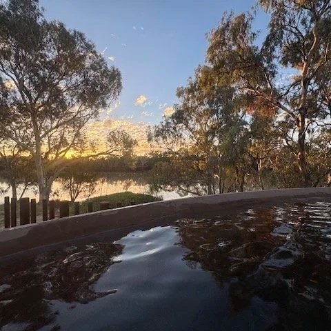
The One Ton Post sits close to the Queensland–NSW border communities along the Barwon River. From here, it’s an easy run back toward Nindigully Pub, a natural place to refuel and reset after the detour. The town of Mungindi is nearby and home to the Mungindi Hot Artesian Pool, a welcome soak after time on dusty roads. The larger regional centre of Goondiwindi is also within reach for supplies, river walks, and a longer stop if needed.
Fast Facts
Location: Near Mungindi, Queensland–NSW border
Distance: Approx. 400 km detour (depending on route)
Traditional Owners: Gamilaraay people
Access: Unsealed roads
Facilities: None
Walking Track: Informal riverbank access
Best Time to Visit: Spring and autumn
Dog Friendly: Yes (on lead)
Things That Could Kill You (Probably Won’t)
A semi-serious guide to surviving Australia. Mostly common sense, occasionally luck.
Distance: This is a commitment detour. Plan fuel and water carefully.
Heat: Very limited shade and high summer temperatures.
Road conditions: Unsealed roads can change quickly after rain.
If this post helped, you can support our work here.
Other updates you may like…

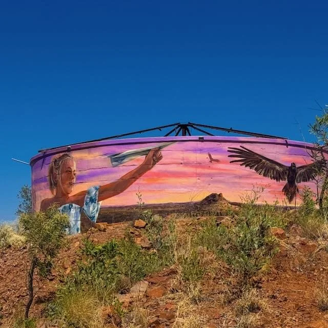


Three days out to Boulia via Poddy Creek and the Middleton Hotel, the Min Min Encounter, outback sunsets and no actual Min Min sightings. Then north to a spectacular free camp at Dajarra Dam on the way to Mount Isa.