

The Ochre Pits: A Sacred Palette
Nestled in the heart of the West MacDonnell Ranges, the Ochre Pits offer a fascinating glimpse into Australia’s rich cultural and natural history. This striking site, with its layered cliffs of vibrant red, yellow, and white ochre, has been a sacred place for the Arrernte people for thousands of years.
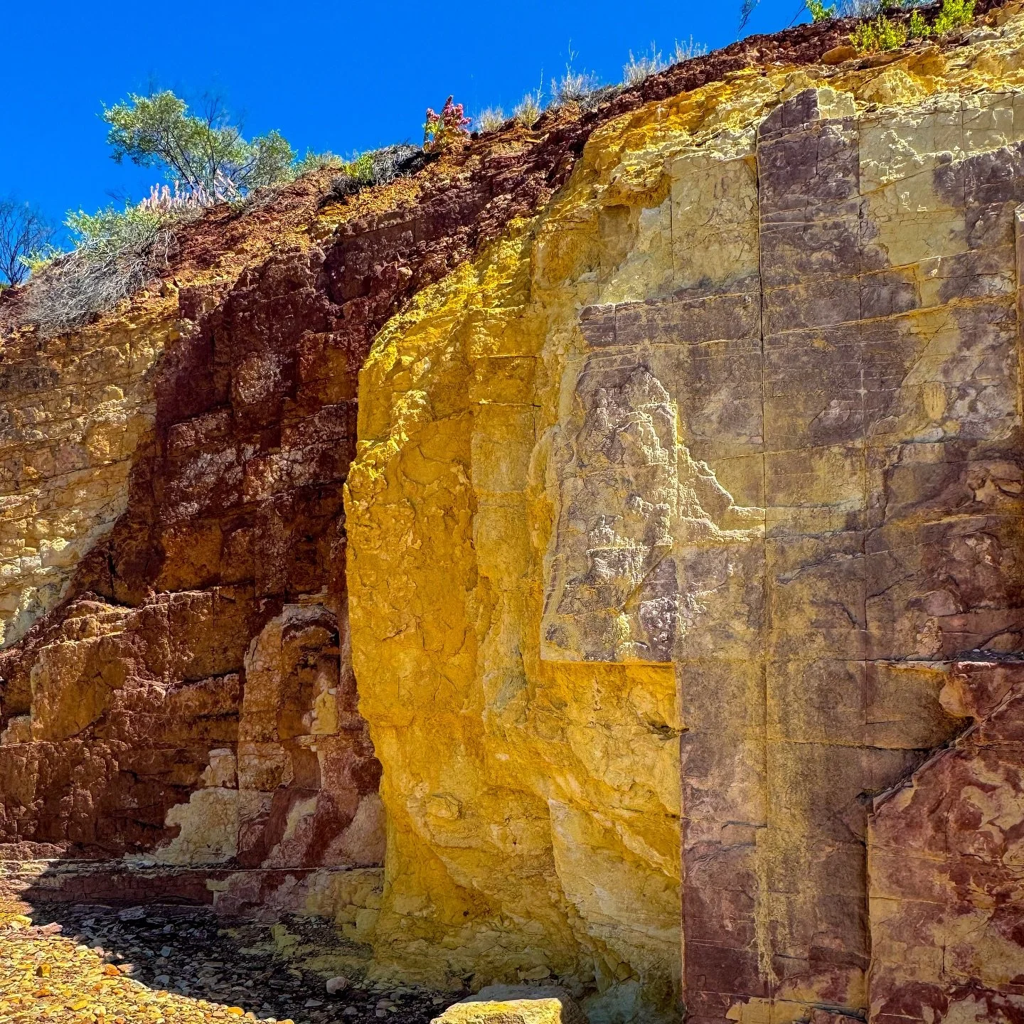
The Ochre Pits are a place where colour and culture meet. The cliffs shimmer with bands of red, yellow, orange and white, glowing brighter the closer you step.
For the Western Arrernte people, this is a sacred site that has been used for thousands of years. The ochre here was, and still is, gathered for ceremonies, painting, and trade. Each hue holds meaning: red represents strength and the earth, white represents spirit, and yellow represents the sun. The pigments were carried far across Central Australia, traded along songlines that connected communities and stories long before roads existed.
Standing before the cliffs, it’s easy to see why this place is revered. The colours shift with every change of light — from deep crimson at sunrise to soft gold by late afternoon. The air is still, the ground hot beneath your feet, and the only sound is the faint rustle of wind moving through spinifex.
A short, level path leads from the car park to the pits, making it one of the most accessible stops in the West MacDonnell Ranges. It’s a gentle walk, yet one that carries a sense of ceremony, a quiet reminder that you’re entering a place with deep cultural roots.
When you visit, it’s essential to treat the site with care. Take only photos, not ochre.
This is still a living site, part of a story that stretches across tens of thousands of years. The Ochre Pits are a reminder of the enduring relationship between people and the land in Australia’s Red Centre.
Sign up for more stories from the road
Get our latest posts and travel updates straight from the red heart of Australia. Join our newsletter.


Ochre Pits
The Ochre Pits are located within the Tjoritja / West MacDonnell National Park, around 110 kilometres west of Alice Springs. The site features naturally occurring ochre cliffs formed over millions of years as iron oxide and clay minerals weathered and compressed within the sandstone.
The colours vary depending on the amount of iron and other minerals present, from bright yellows and oranges to deep purples and whites. These pigments have been mined and used by the Western Arrernte for millennia, making this one of the most culturally significant and visually striking sites in Central Australia.
How to Get There
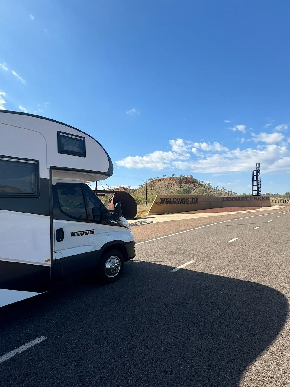
The Ochre Pits sit just off Namatjira Drive, part of the sealed loop that runs through the West MacDonnell Ranges. It’s roughly a 90-minute drive from Alice Springs, with the turnoff clearly signposted.
There’s a small car park, picnic area, and a short, accessible walking track (about 300 metres return) that leads to the main viewing area. The road and site are suitable for motorhomes and caravans.
What to See, Tours and Activities
What we did:
Visited the Ochre Pits as part of a full-day West MacDonnell Ranges tour with Autopia Tours, departing from Alice Springs.
Walked the short track from the car park to the ochre cliffs, where our guide shared stories about the site’s cultural importance to the Arrernte people.
Stopped to admire the layers of colour up close, learning how ochre was traditionally used in ceremony, art, and trade across Central Australia.
Continued along the scenic route through the ranges, stopping at Ellery Creek Big Hole, Ormiston Gorge, and other key landmarks through Tjoritja National Park.
Other highlights you might explore:
Ellery Creek Big Hole – A nearby waterhole surrounded by steep red cliffs, ideal for a swim or picnic stop.
Ormiston Gorge – Offers walking trails and a permanent waterhole framed by striking orange rock walls.
Serpentine Gorge and Serpentine Chalet Dam – Quieter spots in the West Macs with easy short walks and scenic lookouts.
Tjoritja / West MacDonnell National Park – Home to countless geological and cultural sites, from ghost gum-studded valleys to ancient riverbeds
When to Visit
The best time to visit the Ochre Pits is between April and September, when days are cooler and the colours of the cliffs appear most vibrant under softer light.
Summer can bring extreme heat and occasional flash flooding in nearby creeks, so if you’re visiting then, aim for early mornings or late afternoons.
Final Thoughts
The Ochre Pits aren’t grand in scale, but their presence lingers. It’s a place that hums quietly with history — a reminder that beauty and meaning often sit side by side in the desert.
Standing before those painted cliffs, it’s hard not to feel a sense of reverence. You leave with a clearer understanding of how deeply the land and its people are connected, and how those connections continue to shape the heart of Australia.
What’s Nearby
Further west, the road leads to Ormiston Gorge. One of our favourite stops in the West Macdonells, where the water runs cool and the cliffs glow at dusk. Heading back toward Alice Springs, don’t miss Simpsons Gap. An early-morning spot where black-footed rock wallabies can sometimes be seen among the shadows. Between them, these places tell the story of Central Australia’s land and light — each with its own rhythm, all part of the same vast songline.
Fast Facts
Location: Tjoritja / West MacDonnell National Park, Northern Territory
Distance from Alice Springs: 110 km west via Namatjira Drive
Traditional Owners: Western Arrernte people
Access: Sealed road, suitable for all vehicles and motorhomes
Facilities: Car park, picnic area, toilets
Dog Friendly: Not permitted within the Tjoritja / West MacDonnell National Park
Walking Track: 300 m return, easy grade
Best Time to Visit: April to September for cooler days and softer light
Keep travelling with us
We’re continuing our journey through the West MacDonnell Ranges.
From ochre cliffs to gorges, waterholes, and red desert tracks. Join our newsletter for upcoming posts, new photos, and route updates.
You can find more about the West MacDonnell Ranges National Park on the NT Parks website

Other updates you may like…


Standley Chasm changes completely depending on the light. Here’s a quick guide covering the best time to see the glow, how long the walk takes, and what to expect when you arrive.