Kata Tjuṯa: Walking with Giants
We’ve seen photos of Kata Tjuṯa, but nothing really prepares you for the scale. These ancient domes rise up from the red earth like sleeping giants, and walking among them is something else entirely.
We were up before sunrise, jackets zipped and helmets on, for a motorbike ride out to the Kata Tjuṯa viewing platform. The air was sharp and still, the desert just starting to stir. As the first light hit the domes, they turned from deep purple to glowing red, shifting through colours you’d swear no camera could catch. It was one of those moments that makes you forget the early alarm and cold fingers.
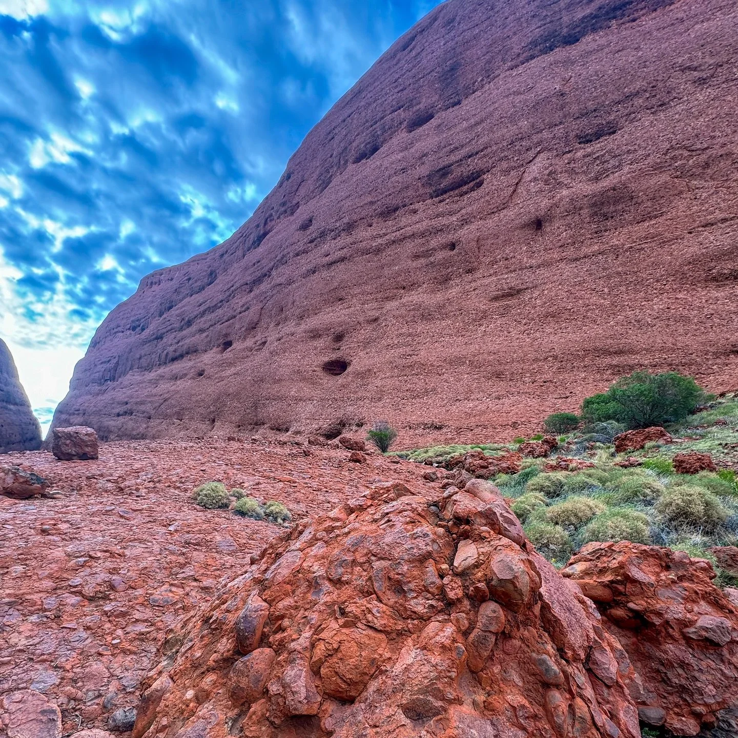
We started with the Valley of the Winds Walk. It’s a bit of a hike at just under 8 km if you do the whole loop, but the views make it worth every step. The trail winds through gaps and gullies between the domes, with moments of cool shade followed by open stretches of ochre-red rock and endless sky. We took it slow, stopping often to take it all in. There’s a hum here, a kind of deep stillness that settles into your bones.
Later, we made our way to Walpa Gorge. It’s a shorter walk, and a bit easier underfoot, but just as breathtaking. The narrow path between two of the largest domes channels the breeze, giving the place its name, Walpa, which means “wind” in Pitjantjatjara. We found a quiet spot at the end to sit and listen. No traffic. No chatter. Just the rustle of wind through spinifex and the occasional bird call.
There’s something about Kata Tjuṯa that stays with you. Maybe it’s the sheer size, or the deep sense of presence the land holds. Maybe it’s just that feeling of being very small…in the best possible way.
From the domes of Kata Tjuṯa, we turned our wheels toward the heart of the desert, Uluru. You think you’re ready for it, but nothing quite prepares you for the feeling of standing in front of that rock.
If you enjoy stories like this — the quiet, humbling kind that stop you in your tracks — join our Travel Dispatch. It’s where we share the road behind the photos and the tales that linger long after the dust settles.
Kata Tjuṯa
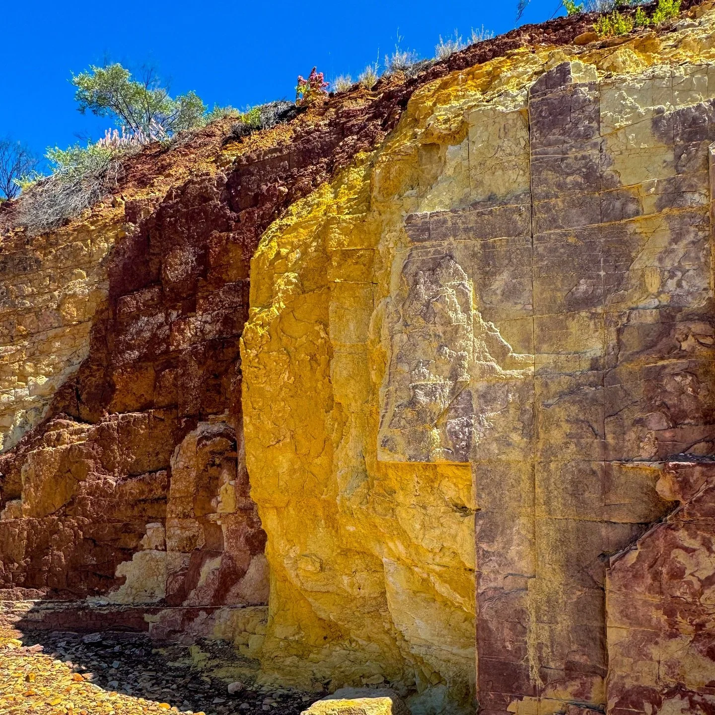
Also known as the Olgas, Kata Tjuṯa lies 50 km west of Uluru within Uluru–Kata Tjuṯa National Park. Comprising 36 domes of red conglomerate rock, it’s a place of deep spiritual significance to the Anangu People and one of Central Australia’s most striking landscapes.
How to Get There
Kata Tjuṯa is about a 40-minute drive west of Yulara via the Lasseter Highway. The road is sealed all the way, with parking and facilities at both Valley of the Winds and Walpa Gorge trailheads. A park pass is required and can be purchased online or at the entry gate.
What to See, Tours and Activities
What we did:
Hiked the Valley of the Winds full loop for sweeping views and deep silence.
Wandered the Walpa Gorge Walk, cooled by its namesake wind.
Took time to sit quietly, letting the desert soundscape do the talking.
Visited at sunrise for the changing light across the domes.
Other highlights you might explore:
Join a cultural walk led by Anangu guides.
When to Visit
April to October offer cooler days for hiking. Temperatures soar in summer, so start early, carry plenty of water, and heed park warnings about heat-related closures.
Final Thoughts
Kata Tjuṯa feels alive with shifting light, echoing wind, and an ancient calm that seeps into you if you sit still long enough. It’s not just a place to see; it’s one to listen to.
What’s Nearby
From Kata Tjuṯa, it’s a short drive east to Uluru, where the desert’s heartbeat continues in sandstone form. The road may be familiar, but the feeling never is.
Fast Facts
Location: Uluru–Kata Tjuṯa National Park, Northern Territory
Distance: Uluru to Kata Tjuṯa – 50 km
Traditional Owners: Anangu People
Access: Sealed via Lasseter Highway; park entry fee required
Facilities: Toilets, shaded rest areas, parking, information displays
Walking Track: Valley of the Winds (8 km) & Walpa Gorge (2.6 km)
Dog Friendly: Not permitted in the national park
Best Time to Visit: April – October
Things That Could Kill You!
This one’s a serious guide to surviving Kata Tjuta.
Heat and Dehydration: Temperatures climb quickly, even in the early morning. Carry more water than you think you’ll need, wear a hat, and rest often in shaded areas.
Slippery Rock: The paths can be uneven and steep in parts. Take your time on descents, especially after rain, the rocks can be slick.
Closed Tracks: When the park posts warnings, they mean it. Track closures happen for safety, not inconvenience. Check before setting out.
If you’ve enjoyed this stop, join our Travel Dispatch, so you won’t miss the top secret dispatches. The behind-the-scenes stories and quiet moments we only share with our road family.
Other updates you may like…
We arrived dusty and travel-worn, but Alice Springs greeted us with warmth, colour and comfort. From quirky cafes to red desert sunsets — don’t believe everything you read about Alice.
We returned to Uluru with fresh eyes, riding out for sunrise, circling the base, and watching rain turn the rock to copper. Quiet, powerful, and unforgettable—the red heart of Australia.
Massive, mysterious and far less crowded than Uluru, Kata Tjuṯa blew us away. We wandered among towering domes, soaked in the silence, and left feeling tiny, dusty, and full of quiet awe.
We hiked the Rim Walk at sunrise, cooled off in the Garden of Eden, and took to the skies for a birthday flight. Kings Canyon is vast, ancient, and one of the Territory’s true wonders.
Often, when travelling together, it’s great to visit places individually so we can each have a different point of view. Neil’s quieter view of Ormiston Gorge. Red walls, soft light, and the sound of wind through the ranges.
Cameron’s take on Ormiston Gorge. A cool desert waterhole framed by red cliffs and silence. A refreshing swim, a perfect view, and a reminder of how still the Outback can be.
Hidden in the West MacDonnell Ranges, the Ochre Pits reveal layers of colour and culture. Once used by the Arrernte people for ceremony and trade, they remain a sacred reminder of Australia’s enduring connection to land.
A short, bright walk through one of the Red Centre’s most dramatic natural landmarks. Standley Chasm glows with midday light and cultural depth, cared for by the Western Arrernte people of Central Australia.
This stunning natural landmark feels like a hidden sanctuary, where the arid landscape meets the cool refuge of a dry creek bed nestled between towering cliffs.
Among the giant granite boulders of Karlu Karlu, the desert feels timeless. Sunrise and sunset light up the Devil’s Marbles in colour and silence, revealing a sacred landscape shaped by both nature and Dreaming.
Tennant Creek might look tough, but give it time and it’ll surprise you. Gold mining, local culture, and a town working hard to shape its future. Proof that hearts beat louder than headlines.
Crocodylus Park in Darwin brought us face to face with the Territory’s wildest locals. From croc feedings to holding a baby reptile, this visit was thrilling, educational, and a little bit terrifying.
Territory Wildlife Park at Berry Springs offers a relaxed way to explore Top End wildlife. We wandered open trails, watched birds in free flight, and learned how wetlands, forests, and savannahs shape life in the Northern Territory.
The Darwin Botanic Gardens gave us a quiet break from the city. Rainforest paths, tropical plants, a shady waterfall area and easy walking. A simple, relaxing morning in one of the NT’s best green spaces.
The Darwin Aviation Museum gave us a steady half-day indoors. A B-52 bomber, military aircraft, WWII history and curious stories from NT aviation. A cool, informative break just minutes from the city.
Darwin’s build-up delivered heat, humidity and some of the best skies we’ve seen. Slow days, big clouds and long sunsets showed us a different side of the Top End. Intense, colourful and uniquely tropical.
Mindil Beach Markets gave us a classic Darwin evening. Warm air, good food and a sunset crowd drifting to the sand. A relaxed mix of colour, flavour and that dry-season atmosphere the Top End does so well.
The Darwin Oil Storage Tunnels offered a calm step into the city’s wartime past. Cool underground chambers, simple displays and a quiet look at how Darwin prepared for air raids during WWII.
The NT Legislative Assembly gave us a calm, informative look at Territory politics: modern architecture, guided tours and stories like the 1996 Remonstrance. A thoughtful Darwin stop for anyone interested in how the Top End governs itself.
Dundee Beach gave us a quiet NT coastal break. With long sand, wide horizons, fishing boats heading out and a sunset worth sitting still for. No swimming here, just the sea breeze and the feel of the Top End coast.
Our airboat trip with Northern Territory Airboats gave us a fast, quiet look at the Bynoe wetlands. Crocodiles on the banks, birdlife across the floodplains and a guide who knew the country well. A relaxed Top End wildlife experience.
Litchfield’s waterfalls and swimming holes gave us three days of cool, easy walking and clear water. From Florence Falls to Buley and Wangi, this Top End park delivers exactly what hot travellers need.
Adelaide River blends wartime history, weekly markets, and Top End quiet. We wandered the War Cemetery, chatted with locals at the dry-season market, and found a town that carries both stillness and life with ease.
Tucked away in the bush near Adelaide River, this vast complex was once one of the largest fixed installations in the Northern Territory during the war.
Robin Falls, tucked away near Adelaide River, is one of those places that feels like a secret waiting to be shared.
Pine Creek gave us good pub food, a shed packed with classic cars, and a quick look at the old Enterprise Pit. A small Top End town with plenty of character, worth slowing down for.
Nitmiluk Gorge gave us golden cliffs, a quiet sunset cruise and stories from Jawoyn Country that stayed with us. We barely scratched the surface, and it’s already high on our must-return list for next time.
Our time in Katherine gave us the chance to experience the heart of the Northern Territory. This charming town, rich in history and surrounded by natural beauty, offered plenty to explore.
After weeks in the dry, dusty outback, arriving at Bitter Springs and Mataranka felt like stepping into paradise. We decided to spend a full week here, giving ourselves the time to relax, recharge, and soak in the natural beauty of the region.
Cameron is a travel writer, photographer, and freelance copywriter with more than fourteen years of experience crafting stories that connect people and place. Based on the road in a motorhome with his partner, he documents Australia’s quieter corners through Off the Main Road, a travel journal devoted to the towns, landscapes, and characters often overlooked by the tourist trail.
His writing blends observation with lived experience, drawing on a professional background in brand storytelling. Blending visual storytelling with a writer’s eye for detail, Cameron captures moments that reveal the character of regional Australia—from weathered towns and open landscapes to the honest rhythm of life across Australia.
Standley Chasm changes completely depending on the light. Here’s a quick guide covering the best time to see the glow, how long the walk takes, and what to expect when you arrive.